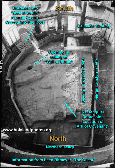
Foundation Stone From Above

View looking down on the sacred stone, often called "The Foundation Stone. North is at the bottom, west to the right, south on the top, and east to the left.
The photo was taken from the Dome sometime between 1900 and 1920. Notice that around the periphery, there is grating between the columns. This grating was put in place during the time that the Crusaders(!) controlled Jerusalem (1099-1187, 1229-1244). It is now in the Islamic Museum located in the southwest corner of the Haram.
If Leen Ritmeyer's reconstructions are correct, then this rock was where the Holy of Holies was located during the First and Second Temple Periods. The back of the Holy of Holies was on the west (right) where the rock scarp is clearly delineated.
The photo is from the Matson Collections, Public Domain, titled "The rock of the Dome of the Rock Corrected" downloaded from Wikipedia. Dome of the Rock. (2023, October 26). In Wikipedia. https://en.wikipedia.org/wiki/Dome_of_the_Rock
